Thalweg
Line of lowest elevation in a watercourse or valley
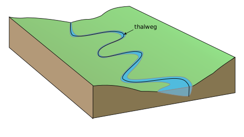
In geography, hydrography, and fluvial geomorphology, a thalweg or talweg is the line or curve of lowest elevation within a valley or watercourse. Normally only the horizontal position of the curve is considered (as viewed on a map); the corresponding vertical position is represented in a stream profile. Under international law, a thalweg is instead taken to be the middle of the primary navigable channel of a waterway which is the default legal presumption for the boundary between entities such as states.
From Wikipedia, under CC BY-SA. More on occurri.